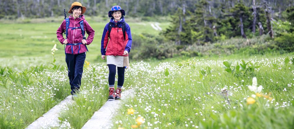
A Trekking Paradise for Beginners and Veterans Alike
In Japanese, the “tai” in Hachimantai refers to flatness. This is appropriate, because Mt. Hachimantai’s summit is remarkably flat, more akin to a plateau in terrain rather than a mountain. This makes it easy to traverse for children and elderly, and removes any need for heavy gear; anyone can trek it with minimal prep!
Both Mt. Hachimantai and Mt. Iwate are counted among Japan’s 100 most famous mountains. A long ridge runs all the way from Mt. Maemori in Appi Kogen, through Mt. Hachimantai and up to Mt. Iwate. The trail that runs along this ridge connects to the Yakehashiri trailhead, and is consequently known as the “Iwate-Hachimantai-Appi Kogen 50km Trail.” For serious trekkers, it’s the one of the most prominent trails in the country.
Among those aiming to challenge this horseshoe-shaped trail, there are many who stop in at Appi Kogen and the Onsenkyō area to sample the many hot springs between hikes.
It’s a trekking paradise that offers courses for people of all experience and fitness levels.
The great expanse of Japan’s national park is waiting!
Recommended Trekking Routes
Trekking Prep
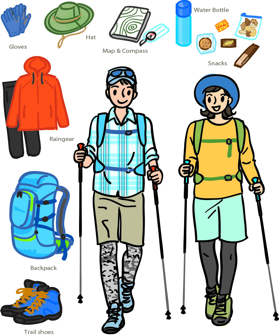
Vital for any Trek
Even on Mt. Hachimantai, which is quite accessible to newcomers, these items are the bare minimum that all visitors should bring.
【Belongings】
- Top & Bottom Raingear
- Map
- Copy of Health Insurance
- Towel
- Food & Water
- Band-Aids
- Snacks
- Gloves
Etc.
Additionally, if necessary:
- Lunch
- Medication
Etc.
【Anti-Infection Items】
- Mask and/or Facemask etc.
- *Stray masks are turning up often.
Please take care that yours isn’t blown away in the wind.
For safe trekking and nature conservation
- If you’re traveling with a guide, please follow the guide’s instructions.
- Check the weather forecast before arriving, and turn back if the weather turns bad.
- Should thunder break out mid-trek, proceed to the nearest evacuation cottage.
- Bear in mind that cellphone signals will not work.
- Even in summer, bring at least a thin long-sleeved garment.
- All trash should leave with you.
- Avoid picking or stepping on alpine plants.
- Avoid approaching or feeding any wildlife.
- Avoid capturing bugs and small animals.
- Avoid straying from the trails.
- Pets often have negative effects on the flora and fauna, so please do not bring them with you.
- *The real-world trails and circumstances may occasionally differ from those presented on this website due to factors such as trail construction/abandonment and terrain erosion.
- *Each visitor is responsible for their own safety. Please stop at the Visitor Center before embarking for the latest trail conditions.
Recommended Trekking Routes
Mt. Hachimantai Summit Area
Travel Time 55min, approx. 2.4km total
Prefectural Border Trailhead→15min, approx.0.5㎞→Mt. Hachimantai Summit→10min, approx.0.4㎞→Hachiman-numa – Gama-numa Observatory→10min, approx.0.4㎞→Ryounso→5min, approx.0.3㎞→Genta-Wakare→10min, approx.0.5㎞→Gentamori→10min, approx.0.5㎞→Genta-Wakare→25min, approx.1.1㎞→Mikaeri Ridge→10min, approx.0.5㎞→Prefectural Border Trailhead
Travel Time 1hr 50min, approx. 4.9km
Kuroyachi-Iriguchi→15min, approx.0.5㎞→Kuroyachi Wetlands→40min, approx.1.5㎞→Gentamori→10min, approx.0.5㎞→Genta-Wakare→15min, approx.0.5㎞→Ryounso→5min, approx.0.3㎞→Hachiman-numa – Gama-numa Observatory→10min, approx.0.4㎞→Mt. Hachimantai Summit→25min, approx.1.1㎞→Prefectural Border Trailhead
Travel Time 1hr 45min, approx. 4.3km
Chausu-Guchi→40min, approx.1.2㎞→Chausu-Sanso→5min, approx.0.2㎞→Mt. Chausu Observatory→5min, approx.0.2㎞→Chausu-Sanso→25min, approx.1.3㎞→Kuroyachi Wetlands→40min, approx.1.5㎞→Gentamori→10min, approx.0.5㎞→Genta-Wakare→15min, approx.0.5㎞→Ryounso→5min, approx.0.3㎞→Hachiman-numa – Gama-numa Observatory→10min, approx.0.4㎞→Mt. Hachimantai Summit→25min, approx.1.1㎞→Prefectural Border Trailhead
Travel Time 3hrs, approx. 7.2km
Mt. Hachimantai Summit Area
Gozaisho / Horaikyo Area
Akanuma Fudo entrance→25 min. about 0.8 km→ Azumaya→20 min. about 0.7 km→ Entrance of promenade→20 min. about 0.7 km→ Azumaya→25 min. about 0.8 km→ Akanuma Fudo entrance
Total course time: 1 hour and 30 minutes Total: about 3.0 km
Travel Time 40min, approx. 4km
Gozaisho / Horaikyo Area
Matsukawa Onsen / Hachimantai Onsenkyo Area
Shichidaki trailhead → 40 minutes about 2.2 km → Shichidaki → 30 minutes about 2.2 km → Shichidaki trailhead
Total course time: 1 hour 10 minutes Total: about 4.4 km
Mt. Gentagatake Trailhead →60min, approx.2.2㎞→ Junction →60min, approx.1.8㎞→ Mitsuishisanso →30min, approx.1㎞→ Mt. Mitsuishi →20min, approx.1㎞→ Mitsuishisanso →40min, approx.1.8㎞→ Junction →40min, approx.2.2㎞→ Mt. Gentagatake Trailhead
Travel Time 4hrs 10min, approx. 10km
Mt. Gentagatake Trailhead →50min, approx. 1.9㎞→ Marumorigawa Deai →75min, approx. 1.6㎞→ Junction →30min, approx. 0.8㎞→ Mt. Gentagatake →15min, approx. 0.7㎞→ Traverse Route Junction →20min, approx. 0.8㎞→ 大Obuka-Sanso →45min, approx. 2.2㎞→ Junction →50min, approx. 1.6㎞→ Marumorigawa Deai →40min, approx. 1.9㎞→ Mt. Gentagatake Trailhead
Travel Time 5hrs 25min, approx. 11.5km

