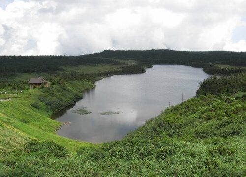
八幡平高原は、標高1,613メートルの台地状の山頂で、静かな池、広大な湿地、広範囲にわたるオオソラビソの森が広がっています。八幡平にある池や沼の中では最大であり、この地域の象徴でもあるのがこの八幡沼です。
山頂が侵食や噴火により台地状になった八幡平の火口湖の一つで、約7,300年前に形成され、周囲約1.5キロメートルに及びます。周囲を一周する遊歩道からは湿地にアクセスが可能で、夏から初秋にかけてはニッコウキスゲ、コバイケイソウ、チングルマ、ワタスゲなどの高山植物が咲き誇ります。
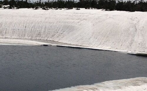
近くの鏡沼は、晩春に起こる自然現象から「八幡平ドラゴンアイ」と呼ばれています。沼の端が解けて水のリングが開き、残った氷の中心部も溶け始めると、上から見ると巨大な龍の目に見えます。美しい一方で、解け始めると危険なため、訪問者は端から離れておく必要があります。
見返り峠は秋田県と岩手県の県境に位置しています。峠からは、東側の八幡平とその池や湿地、南側の岩手山、早池峰山、秋田駒ヶ岳などの山々を一望できます。訪問者は、峠にある八幡平山頂休憩所と駐車場も利用できます。